
TIDE for Research and Operational Oceanography
Research and Operational Oceanography Edition
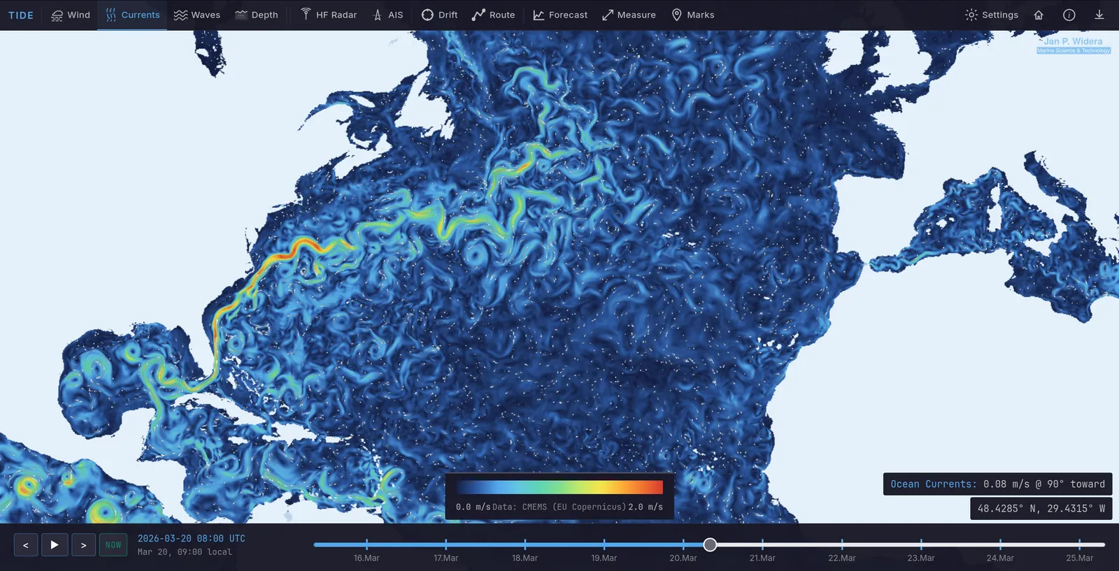
TIDE is a client layer over operational forecast and observational products, built for scientific use. It labels the method behind each uncertainty estimate, states its conventions, and attributes data to its provider. Users work with the underlying fields directly, without an abstraction layer.
Who this edition is for
- National and regional hydrographic institutes
- Research centres with operational forecasting mandates
- University coastal-modelling and physical-oceanography groups
- Civil protection scientific advisory offices
HF Radar with Analytical Uncertainty Propagation
- Reads HF-radar UV products directly (WERA, CODAR, and other installations via standard NetCDF).
- Reads the combined u/v covariance fields (P_uu, P_vv, P_uv) that the manufacturer software (WERA / CODAR) delivers alongside the total-current product. The software derives them from the per-station radial variances through the known station geometry (cf. Lipa & Barrick 1983; Graber et al. 1997). TIDE propagates them analytically into speed uncertainty with the exact first-order formula:
σ_speed² = (u²·P_uu + v²·P_vv + 2·u·v·P_uv) / (u² + v²)
- Station-radial products with per-point σ derived from sigma2_s*.
- The meteogram shows radial velocity time series with error bands from analytical covariance propagation. Lines are drawn in segments that break at NaN, so data gaps do not produce malformed polygons.
Lagrangian Drifter Ingest
- A separate drifter backend polls feeds per campaign, stores the data in a database, and serves thin JSON to the frontend.
- Quality control runs at ingest with a 3 m/s ceiling (western-boundary currents + Stokes + windage). A 1.8 km floor suppresses false positives on short gaps. Failing points are flagged, never deleted.
- Auto-thinning preserves the M2 tidal ellipse (12.42 h period). For analysis windows ≥ 72 h, the thinning interval is capped at 3600 s.
- DSGVO-compliant architecture. Email identifiers are stored only as HMAC-SHA256 (salt ≥ 32 chars), retention pruning runs daily, and login uses magic-link authentication.
- An administrative tool re-runs QC idempotently after threshold changes.
Unstructured Mesh Support
- On-the-fly rasterisation for SCHISM, FVCOM, and FESOM output.
- Demonstrated with publicly available regional SCHISM output at mesh edges down to ~5 m in coastal domains. The effective physical resolution is ~5-10× the edge length after the linear FE basis (cf. Lemarié et al. 2012). A Go caching backend keeps browser interaction smooth.
- Standard input formats (NetCDF, GRIB). No offline pre-processing required.
Meteogram and Point Forecasts
- Time series at any map location for all integrated layers (wind, currents, waves, HF radar).
- Per-model uncertainty visualisation:
- NWP layers: synthetic sqrt(Δt) error growth for horizon illustration
- HF-radar UV: covariance-propagated σ_speed (above)
- HF-radar radials: √(sigma2) per point
- Bracketing-pair temporal interpolation runs on u/v components, never on magnitude/direction. In UV mode this avoids the 0°/360° wrap artefact by construction.
Conventions
- Timestamps: UTC, ISO 8601.
- Coordinates: WGS-84, 4-decimal precision (GPS-grade, ~11 m).
- Wind direction: FROM (meteorological convention).
- Current direction: TO (oceanographic convention).
- Wave direction: FROM (WMO Code Table 0877).
- Stokes drift direction negated from MWD per Phillips (1977): U_s = 2π³Hs²/(gTp³).
- Speeds in m/s; cm/s available on request for drifter-velocity outputs.
- Nodata sentinel: -9999 on backend, NaN on client.
Known Limitations
- TIDE performs no data assimilation. Forecast skill is inherited from upstream products.
- Temporal interpolation is applied to u/v components, never to magnitude or direction. This avoids the 0°/360° wrap artefact by construction. Data products supplied as (magnitude, direction) are decomposed to u/v before interpolation and recomposed for display.
- Uncertainty is synthetic for the NWP horizon and analytical for HF radar. Plots label the method explicitly.
Methods and Reproducibility
- Source code: available to collaborators on request. Deployment commits are pinned to tagged releases.
- Data-licence acknowledgements required in derivative publications:
- Copernicus Marine Service: "Generated using E.U. Copernicus Marine Service Information; https://doi.org[product-specific DOI]"/.
- ECMWF Open Data: attribution under CC-BY 4.0; cite product and cycle (e.g. "IFS HRES").
- DWD OpenData: attribution "© Deutscher Wetterdienst" under CC-BY 4.0; cite model and cycle.
- HF-radar products: per-operator licence; attribution wording supplied with deployment.
- Reproducibility: TIDE output is deterministic for a given model cycle, timestamp, bounding box, and stride. The drift Monte Carlo is seedable. Figures reproduced with TIDE should record the TIDE version / commit SHA, the model cycle timestamps used, and the parameters (drift object class, ensemble size, seed).